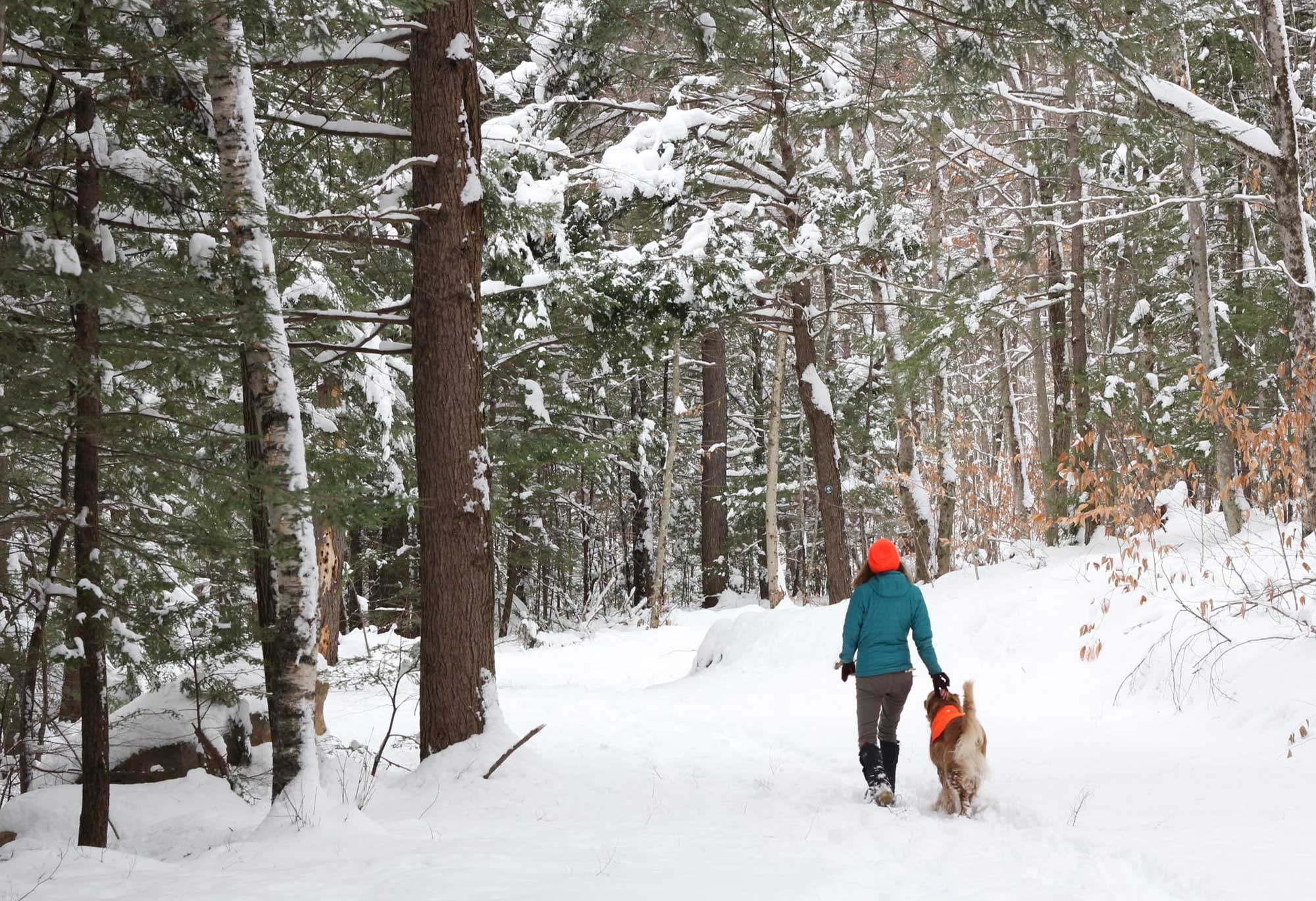


When the pandemic shut down much of the country last spring, many people took to the trails close to home — some of them for the first time. In Coös County — where trails crisscross the northern tier of the state, providing opportunities for hiking, walking, biking, and skiing — some outdoor recreationalists found their way onto those trails thanks to the expanded network on Trail Finder.
The Upper Valley Trails Alliance has been working for the last two years to map Coös County trails on its Trail Finder website, which includes information as varied as directions to a trailhead, elevation gain and average grade, and whether pets are allowed or fees charged. Users can search the site by activity type, and find trails that are accessible to people who use wheelchairs. Now, Trailside Services are being added to Trail Finder – connecting trail users with local businesses, so people know where to hop off the trail for lunch, or where to base their North Country adventures, or where to buy hiking gear, or get a bike repaired. Grants from the New Hampshire Charitable Foundation’s Neil and Louise Tillotson Fund are supporting the work.
“The Tillotson Fund is continuing an economic-development strategy that supports two industries with potential for positive growth throughout Coös County: non-motorized outdoor recreation and energy-efficiency,” said Sonya Salanti, director of Tillotson Funds. “One gap in the human-powered recreation ecosystem has been access to locally-generated trail mapping systems in the northern part of the state. Upper Valley Trails Alliance is working to fill that gap, while also building out a platform to promote area businesses — from bike shops to breweries — who provide services for trail users in the region.”
With a mission to promote trail use through education, outreach, and stewardship, UVTA has managed Trail Finder since 2014, initially including trails in the Upper Valley region of New Hampshire and Vermont. Five years ago, the organization partnered with the University of New Hampshire Cooperative Extension to expand its trail mapping efforts to all of New Hampshire.
“There was a continued growing interest and demand for more trail mapping,” said UVTA Executive Director Russell Hirschler. “As the outdoor recreation community was discussing how to map trails to be able to recognize and promote their recreational assets, we said, ‘We have this great resource. There’s no need for you to reinvent the wheel.’”
UVTA works with the Center for Community GIS to map trails, and Hirschler said Tillotson Fund support has allowed the organization to hire a Trail Finder project manager. Trail managers — from the Appalachian Mountain Club and other non-profit trail groups or from municipalities or land trusts — interested in adding a trail or network of trails use a template to provide information. Mapping through GIS shows a trail’s location, trailheads, parking, viewsheds, landmarks, and elevation changes.
As most avid hikers, mountain bikers, and backcountry skiers know, there is a slew of smartphone apps available to trail users to preview outdoor activities, help determine your location along a trail, and record outings. What makes Trail Finder different is its versatility among various user groups — and its careful dedication to sharing precise information approved by trail managers — rather than crowdsourced by trail users. It’s becoming a resource trail users turn to for initial research.
“We have family members who come visit us from southern New England, and we often want to find new places to take them, or they want to go exploring on their own,” one Trail Finder user told Hirschler. “We found Trail Finder and have loved it. We have learned of new places near our home, and we have shown our family members Trail Finder. They can then go explore trails on their own — knowing how to get there and what to expect.”
Hirschler said the site also provides trail users with peace of mind that the information they find on Trail Finder is accurate and updated.
“Every piece of information that is posted into Trail Finder is trail-manager-approved. It’s all correct, and it’s all current,” said Hirschler. “We give a lot of information for a lot of different things. We don’t give ALL the information for every user. A mountain biker may consider using more than one resource; you may find information about a trail network you didn’t know existed on Trail Finder, and specific trail conditions on the Trailforks app.”
For municipalities and other smaller trail mangers, Trail Finder is providing an invaluable resource, said Sally Manikian, The Conservation Fund’s New Hampshire and Vermont representative, who has worked on community trail projects in Coös County for several years. She points to the hiking trail on Mt. Jasper in Berlin as an example of how the Trail Finder effort has boosted awareness among both local and visiting users.
“Many Coös communities do not have a strong trail club that can take on mapping and promotion of their trails. Mt. Jasper was known by locals for years, but visitors or new residents often had no idea that a trail existed to get to the top of the mountain,” she said. “Within the first six months of Trail Finder’s involvement, Mt. Jasper’s trail was online. Now there is a place where visitors can go and find trail information.”
With continuing Tillotson Fund support, UVTA hopes to achieve several goals by 2022, including adding 60 Coös County trails to the Trail Finder site, increasing traffic to the site by 30 percent, and growing the Trailside Services listings in the northern part of New Hampshire. Some of these goals have been hampered by Covid-19, while others have been seen a boost with the pandemic-driven increase in trail users through the spring and summer.
“When March rolled around and our world significantly changed, we created a Covid portal, where the state agencies that manage recreation in Vermont and New Hampshire could share Covid-related recreation information,” Hirschler said. “Especially during the early days of the lockdown — in April and May — they were pushing people to go to their local trails, and if you don’t know where your local trails are, go to Trail Finder. We’ve experienced a 100 percent increase in website traffic.”
What has been a boon for trail use, however, has been a bit less straightforward for small, local businesses, including many that have struggled to operate amid changing health guidelines. UVTA launched its Trailside Services program this summer. About 20 businesses have signed on to the platform so far, which allows businesses to develop their own free listings with a message targeted to recreationalists.
Dave Harkless lists his Littleton Bike & Fitness shop on TrailFinder — and encouraged the addition of the “Trailside Services” to the site.
“More people will use it if they can use it to find the trails and where they can eat and where they’re going to stay and where they’re going to get their beer afterwards,” Harkless said.
The free listings for local businesses on the non-profit site are a refreshing change from the dozens of for-profit online platforms that continually work to “upsell” their services to small businesses.
“We know that trails and recreation can sustainably support economic growth in areas like Coös County, where a lot of the industry has shifted,” said Hirschler. “We’re trying to give these businesses that are slowly opening up an opportunity to connect with recreational users.”
All of which will help communities in the region thrive.
Related Stories
Through a new lens
Media Power Youth helps young people in Franklin see their hometown from a different angle.
Assistant Safety Commissioner Steven Lavoie receives 2026 Caroline and Martin Gross Fellowship
The fellowship was established in memory of the late New Hampshire House Majority Leader Caroline Gross and the late Concord Mayor Martin Gross to honor dedication to public service. Lavoie will attend an intensive, three-week program with public servants from around the world.

Bow English teacher awarded Christa McAuliffe Sabbatical
Meagan Burd will produce teacher training materials to help high school students become better readers, better learners and more successful adults.